
Dorset is braced for flash flooding as heavy rain sweeps in across the county, with Bournemouth's central gardens already closed as a precaution by Bournemouth Council.
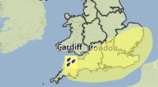
A Met Office severe weather warning is in place until 10pm, with the downpour expected to continue until the afternoon.
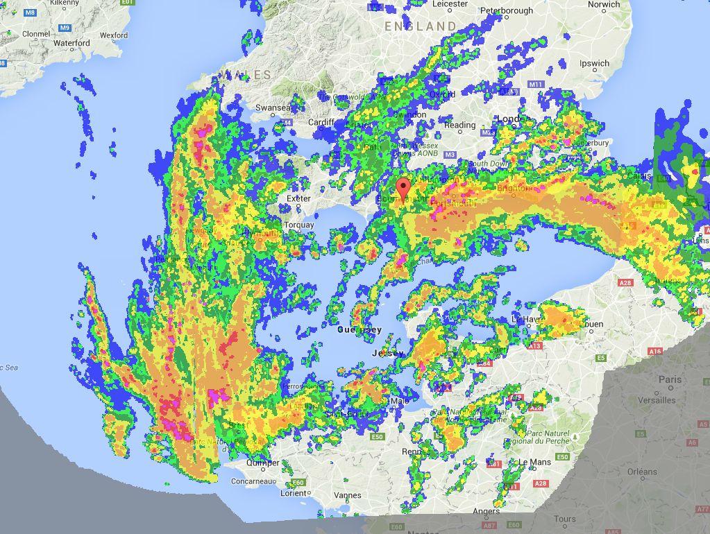
Radar maps show an area of rain moving in from the south.
The Met Office weather warning reads: "An area of rain will run into the UK from the south on Monday morning, with some persistent and heavy rainfall in places.

"The public should be aware of the risk of flooding, including disruption to travel. In addition to this there is the potential for strong winds, particularly around exposed coastal areas.
"A low pressure system is expected to run into the UK from the south on Monday morning, bringing areas of heavy rain particularly across some southern areas of England.
"There remains some uncertainty over this development and the locations of the heaviest rain.
"However, there is the potential for 20-40 mm to fall quite widely with more than 60 mm possible in some places, much of this falling in a short period of time.
The warning covers Bournemouth, Poole and Dorset.
The rest of the week is set to be unsettled. Thunderstorms predicted to hit today are now foreast for Tuesday lunchtime. Wednesday will be sunny and Thursday showery.
Temperatures are expected to be 17C on Monday and 18C for the rest of the week.


Comments: Our rules
We want our comments to be a lively and valuable part of our community - a place where readers can debate and engage with the most important local issues. The ability to comment on our stories is a privilege, not a right, however, and that privilege may be withdrawn if it is abused or misused.
Please report any comments that break our rules.
Read the rules hereLast Updated:
Report this comment Cancel