

AN architectural designer has utilised free software to show the sheer size and scale of the recently approved 24-storey multi-use development in Bournemouth town centre.
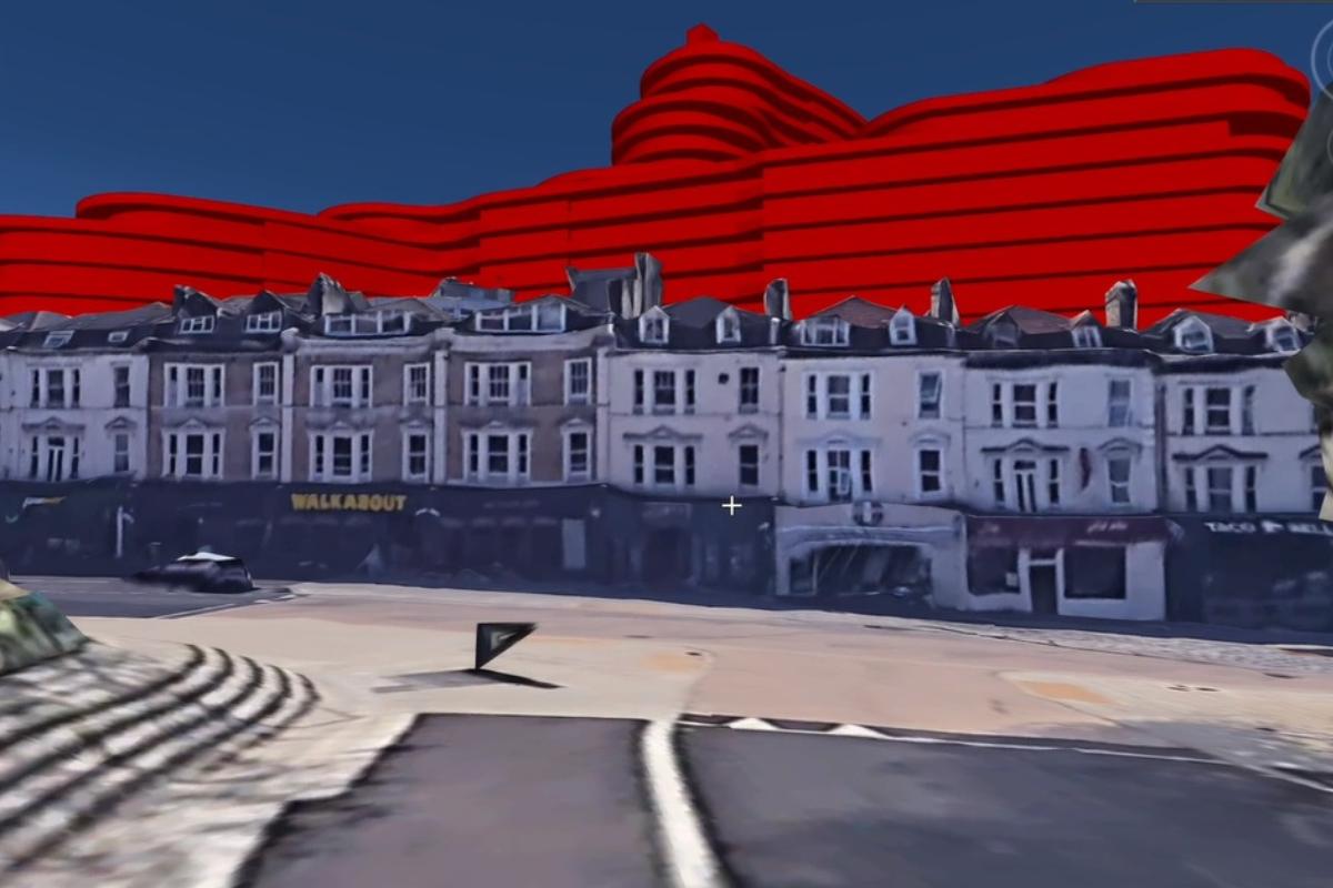
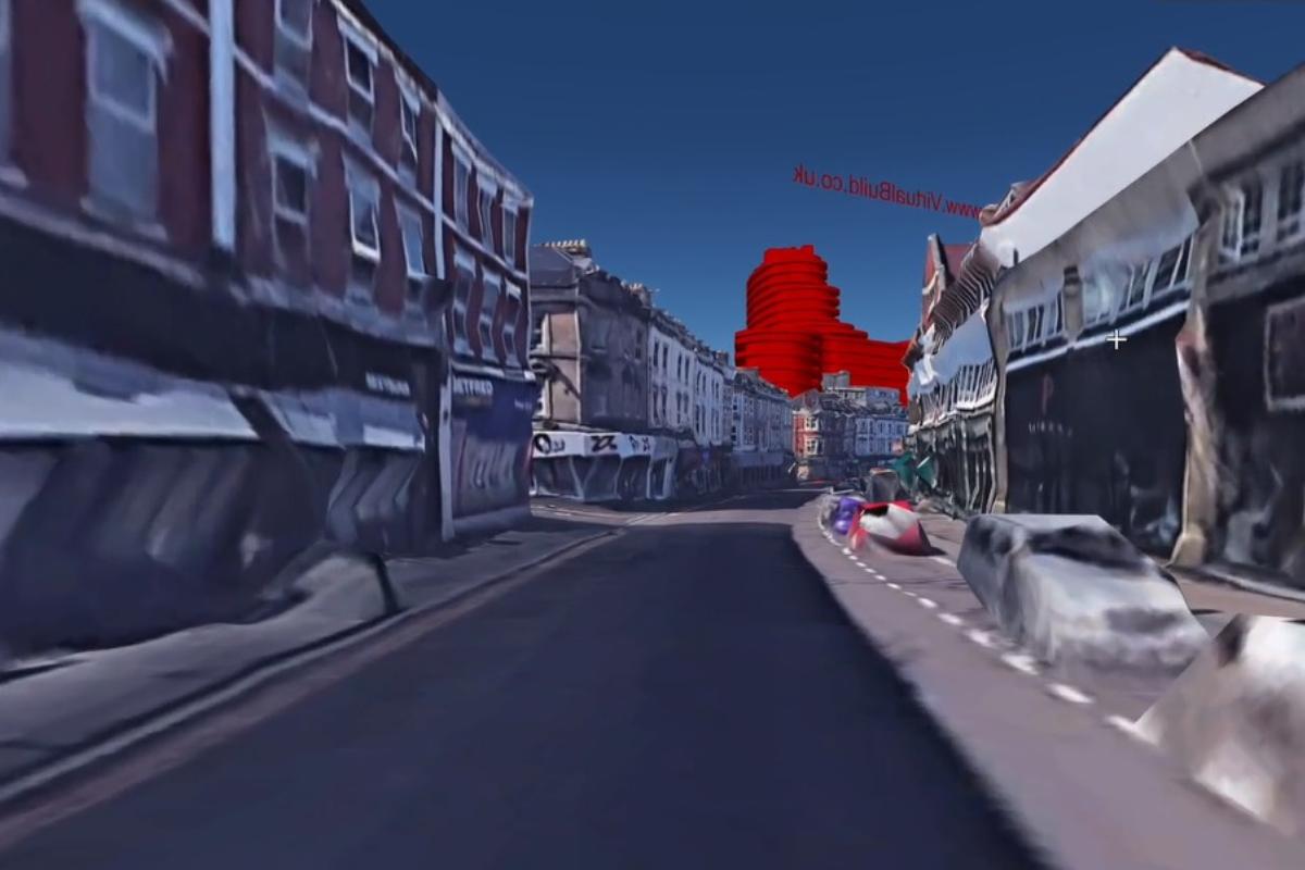
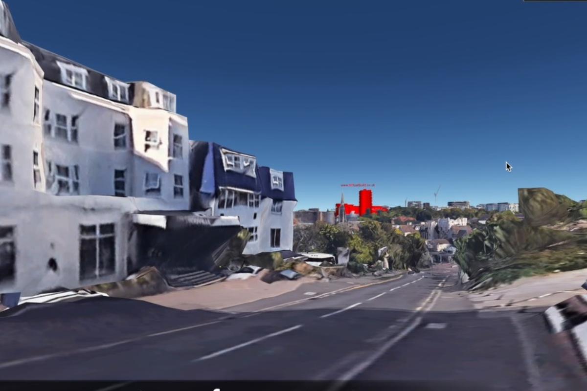
Jason Lawford of Hampshire-based Virtual Build Architectural Studio created a massing model on Google Earth to showcase what impact the eventual Boho Grand complex will have on the Bournemouth skyline.
As reported, BCP Council’s planning committee voted to approve developer Fortitudo’s plans for a £200million residential and hotel tower between Glen Fern Road and Fir Vale Road on January 19.
The development will offer 494 residential flats, a 104-bedroom hotel, a 450-space multi-storey car park as well as a nightclub, boutique cinema, Flip Out adventure park, restaurants and a sky bar.
However, Jason decided to visually impose the complex into Bournemouth using Google Earth as he felt simple 2D images with no interactivity failed to accurately portray the project’s size.

He told the Echo: “As a Bournemouth boy, I commend the council for taking the stand as they try and evolve the town. Whilst, at the same time, I do wonder if they fully appreciated the scale of their decision, which was based upon the information available.
“As an architectural designer and planning professional with over 30 years of experience, I always believe a full set of application information extracted from a 3D model – with traditional plans/elevations together with 3D views – really does aid informed decision-making.
- Read more: £40m hotel development ABANDONED in Bournemouth
- Read more: New developer to start work on building which will be 'one of the largest in Poole'
“This additional service adds a whole new level of understanding to such large projects.”
A video made by Jason shows the 24-storey tower from several vantage points around the town, including Bournemouth beach, Old Christchurch Road and the B3066 Priory Road.
Jason says he has offered his services to BCP Council and believes the technology should be used by all planning authorities. “I am not aware of any other architectural presentation company offering this solution,” he added.
“Using Google Earth as the base context model is a very cost-effective way of having a planning and development ‘digital twin’ to communicate large development ambitions.
“It is a good and impressive building, I just wanted to show it properly within the context of its surroundings.”
Visit virtualbuild.co.uk/virtual-build-architectural-studio-google-model.html for more information.


Comments: Our rules
We want our comments to be a lively and valuable part of our community - a place where readers can debate and engage with the most important local issues. The ability to comment on our stories is a privilege, not a right, however, and that privilege may be withdrawn if it is abused or misused.
Please report any comments that break our rules.
Read the rules hereLast Updated:
Report this comment Cancel