
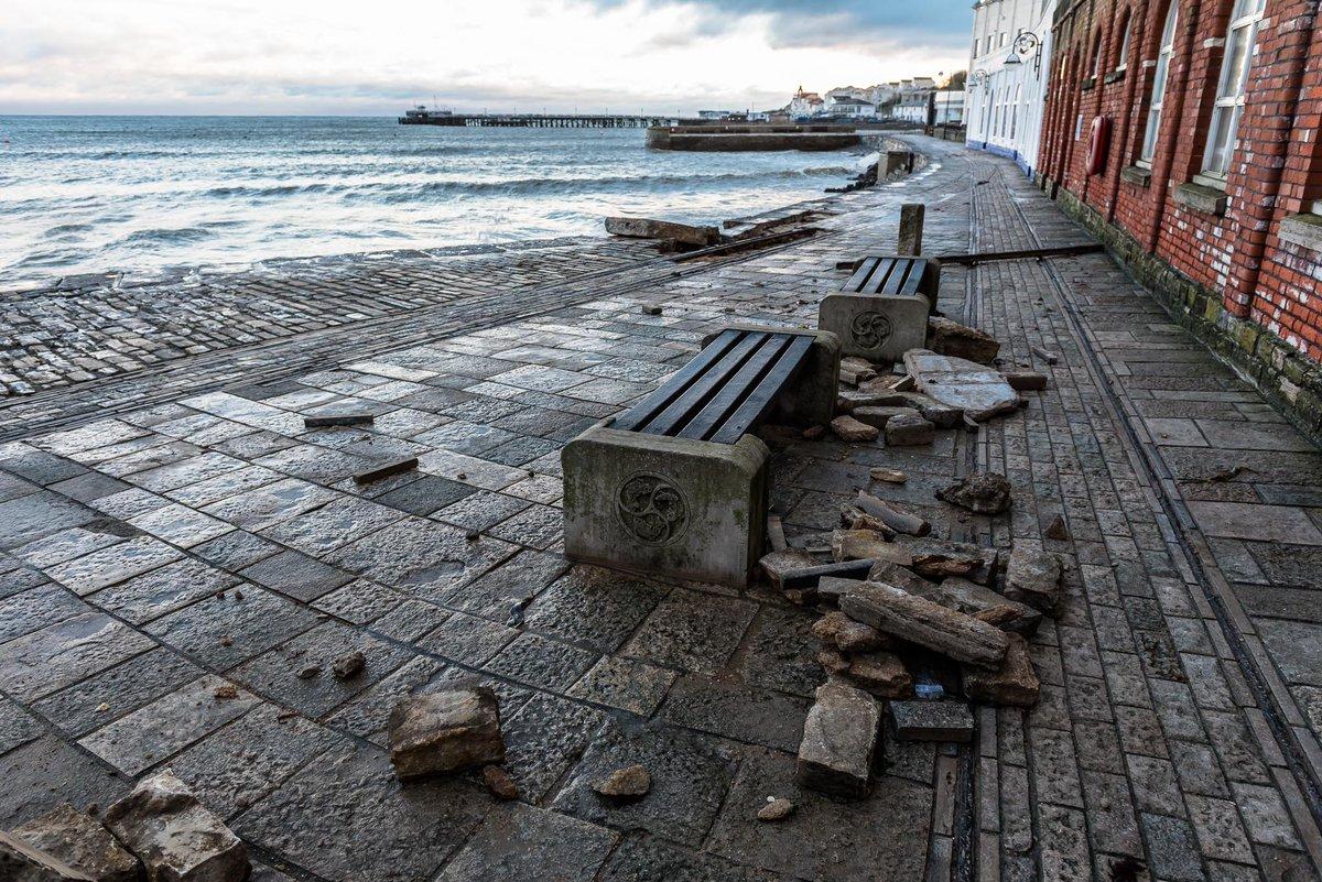
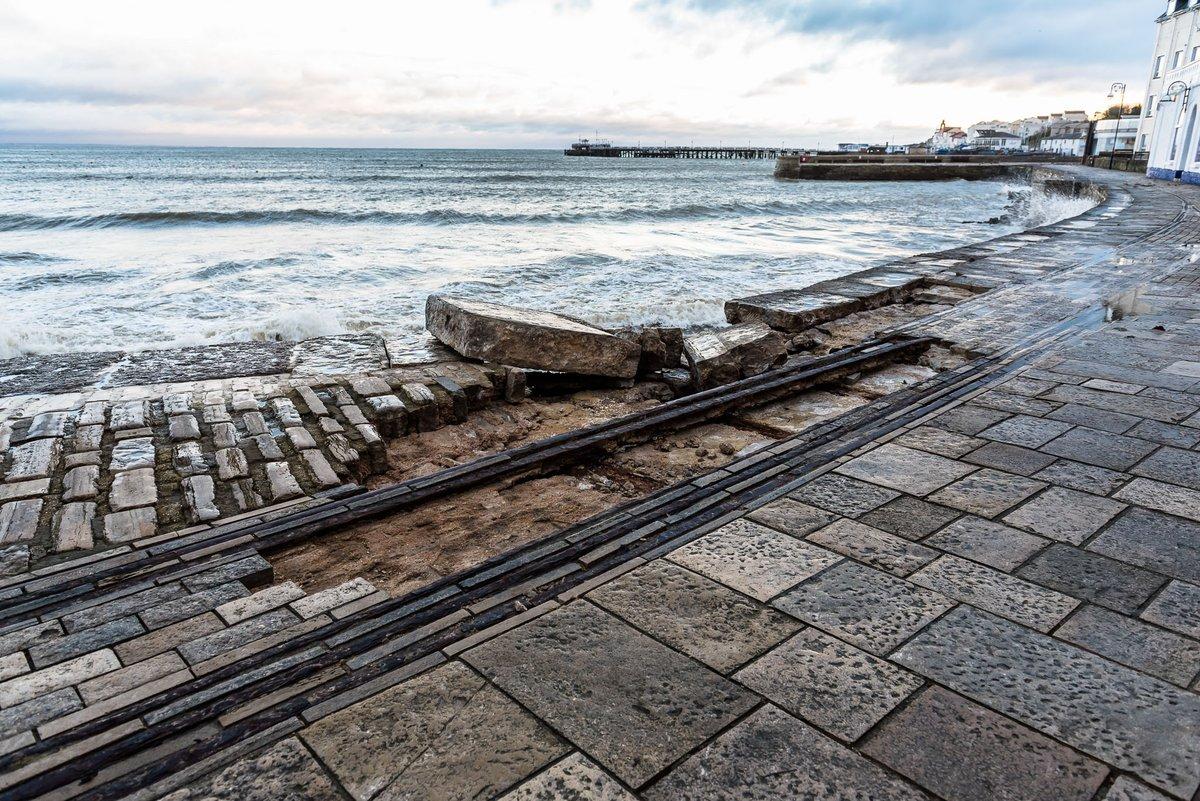
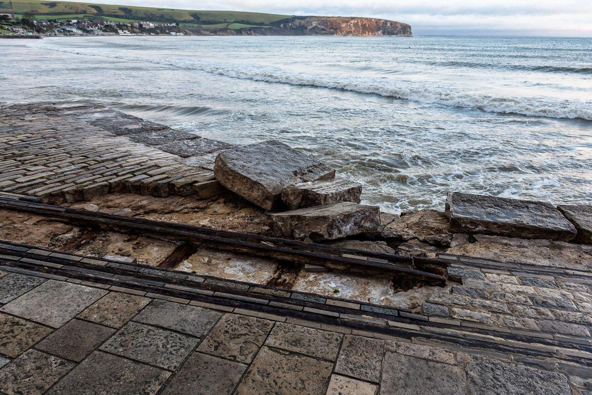
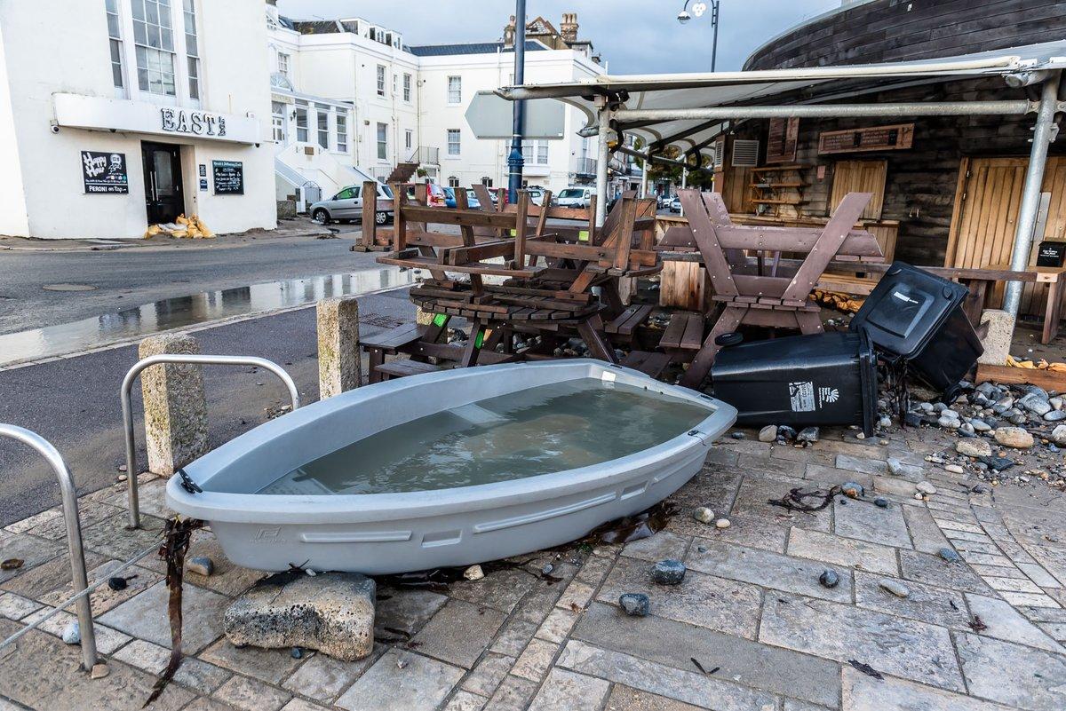
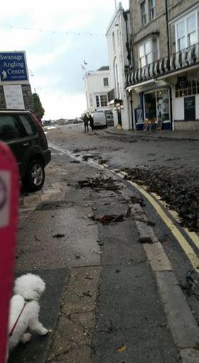
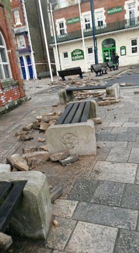
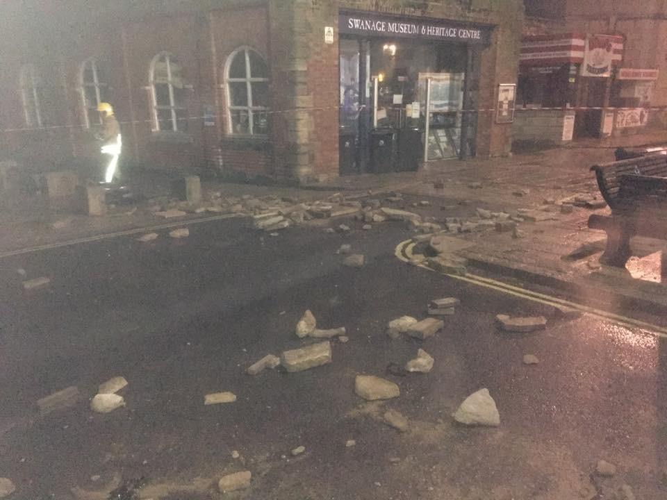
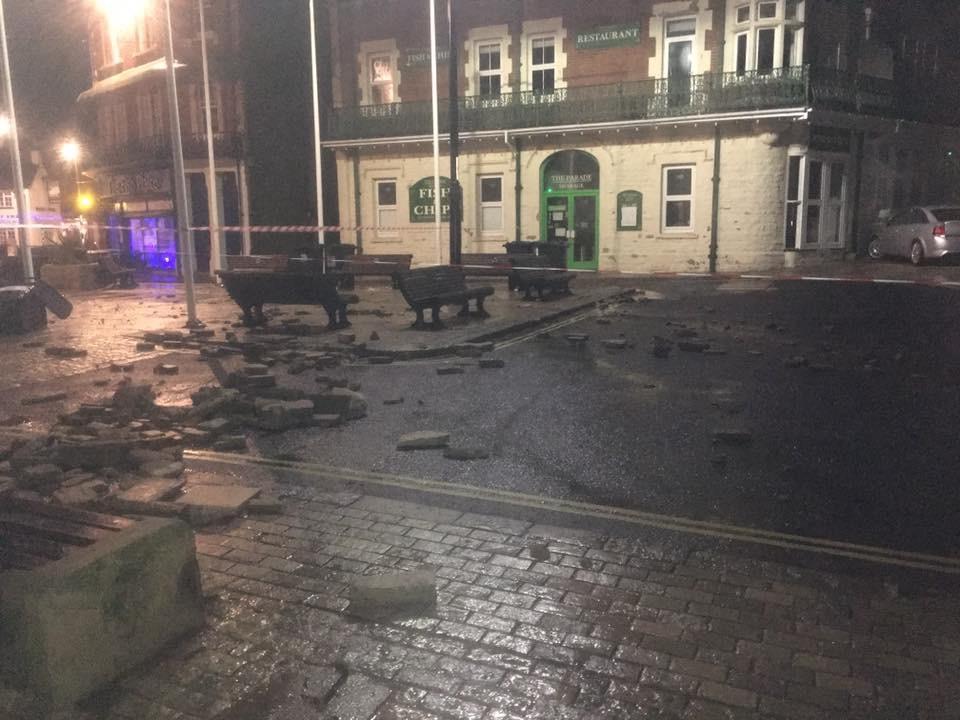
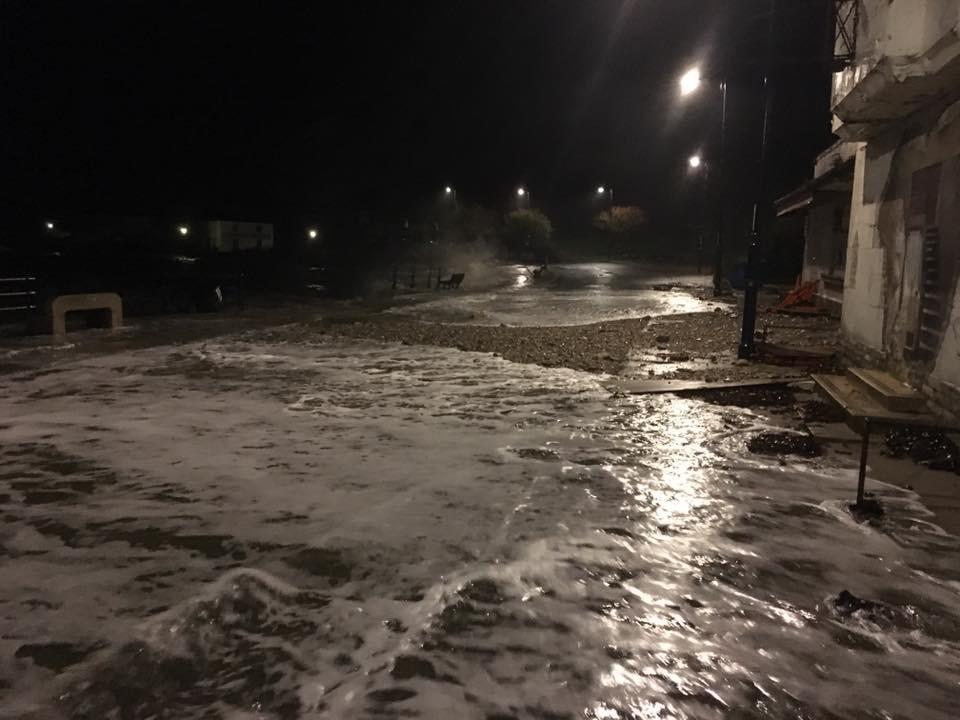


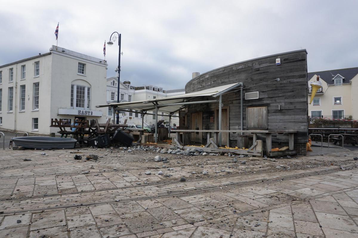
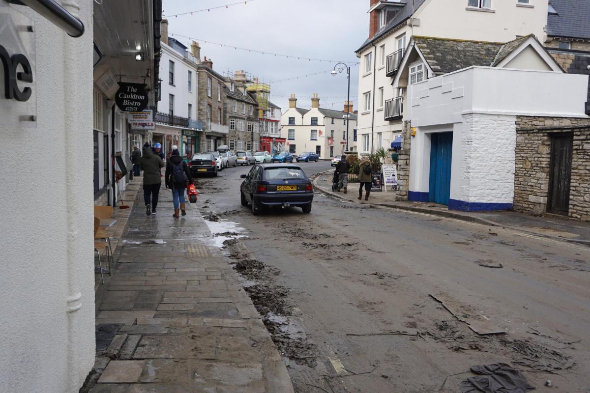

STORM Angus left Swanage with a hefty clean-up bill after smashing the sea wall and flooding the high street.
Hitting the coast over Saturday night, several hours earlier than forecast, the low pressure system swung over Dorset from the west bringing heavy rain and 60mph gale-force winds.
Combined with high tides still affected by 'super moon', which reached its peak proximity earlier in the week, the weather system saw waves as high as 30 feet batter the Purbeck coastline, while a cloudburst brought flooding elsewhere in the county.
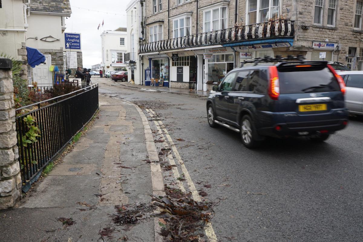
In Swanage yesterday, residents wandered through the seaweed strewn streets to inspect the damage.
Bianca Aga, who lives alongside the sea wall, said she was kept awake by waves booming against the stones.
"I have never seen anything like last night," she said.
"Even sleeping at the back of the house - the whole building was shaking.
"In the new street lights you could see the sea was boiling. The waves coming in combine with those going out and create a 30 foot wave."
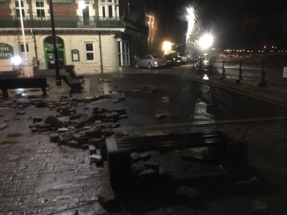
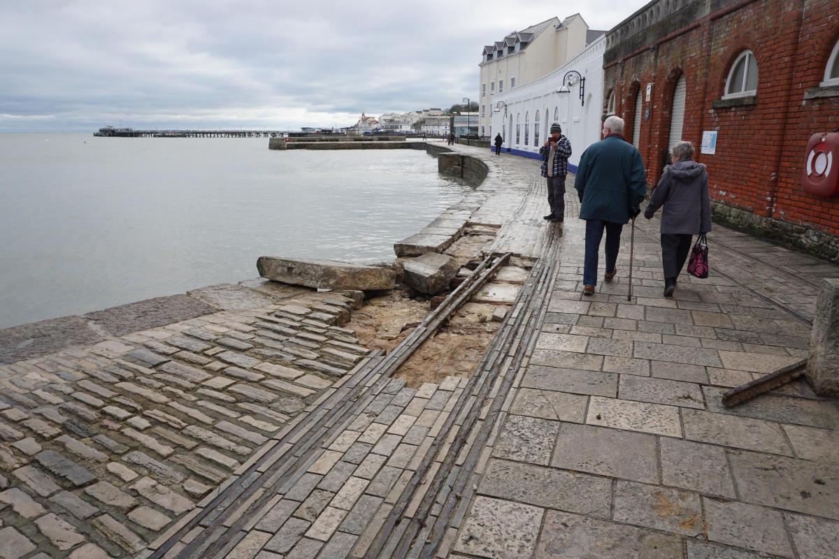
David Haysom, curator of the Swanage Museum, said the damage to the sea wall, which saw stones torn out from under the town's preserved tramlines, was the worst in several years.
"Two years ago there were bad storms that saw quite a bit of damage to the sea wall by the theatre - that was only repaired last year," he said.
"The town faces east so there is normally no problem but every now and then we get something like this."
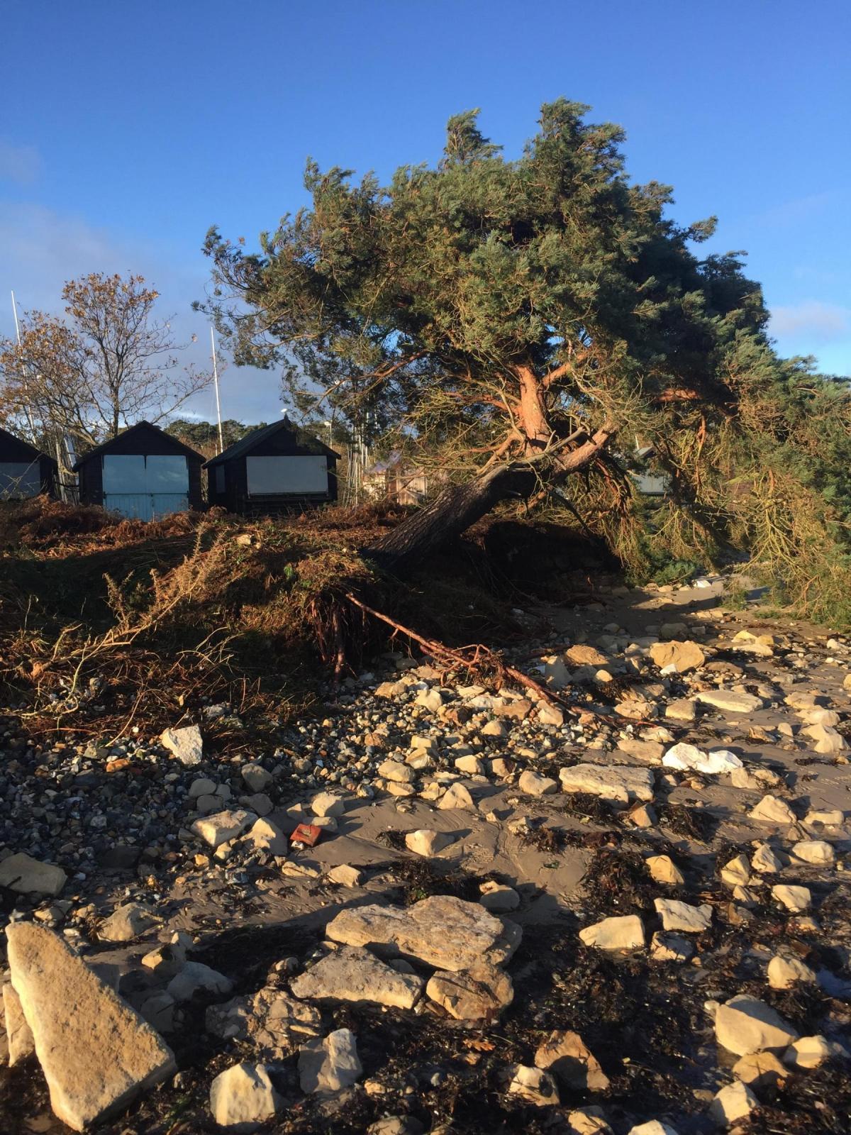
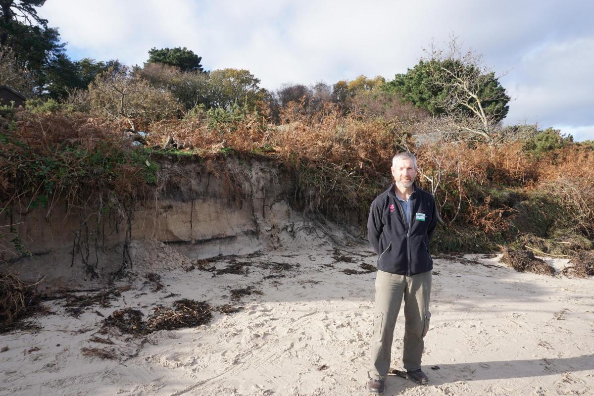
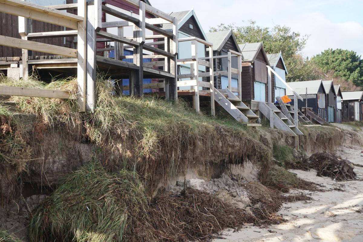
In nearby Studland waves undercut the dunes leaving beach huts' porches dangling over thin air and uprooting trees.
Volunteer beach cleaners from the Sea Shore Scavengers were out in force this morning clearing up the debris.
Among them Kevin Rideout, National Trust visitor experience officer for the area, said: "We had fencing along here to stop people walking on the dunes, that has gone as have the bins.
"A lot of trees have fallen down. The bank has been cut back three metres.
"It is a very changeable coast and quite vulnerable to storm damage, which is made worse by the sea level rising.
"The tide is still quite high after the super moon, which is an unfortunate coincidence."
The group expected to collect some 60kg of debris unearthed by the waves, as the dunes lie over a dumping site.
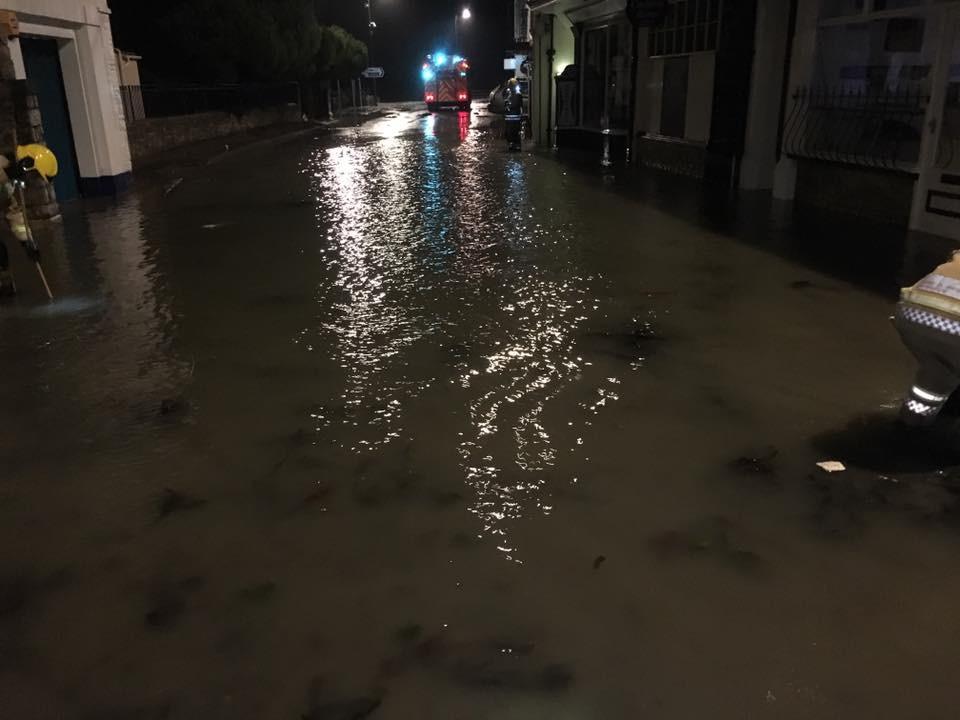
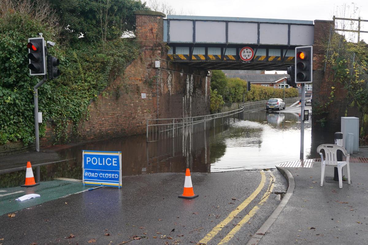
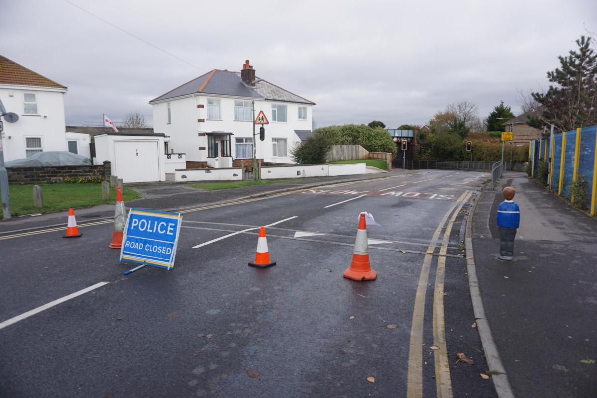
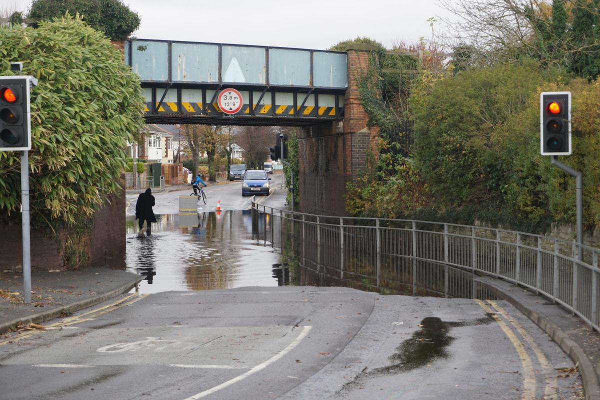
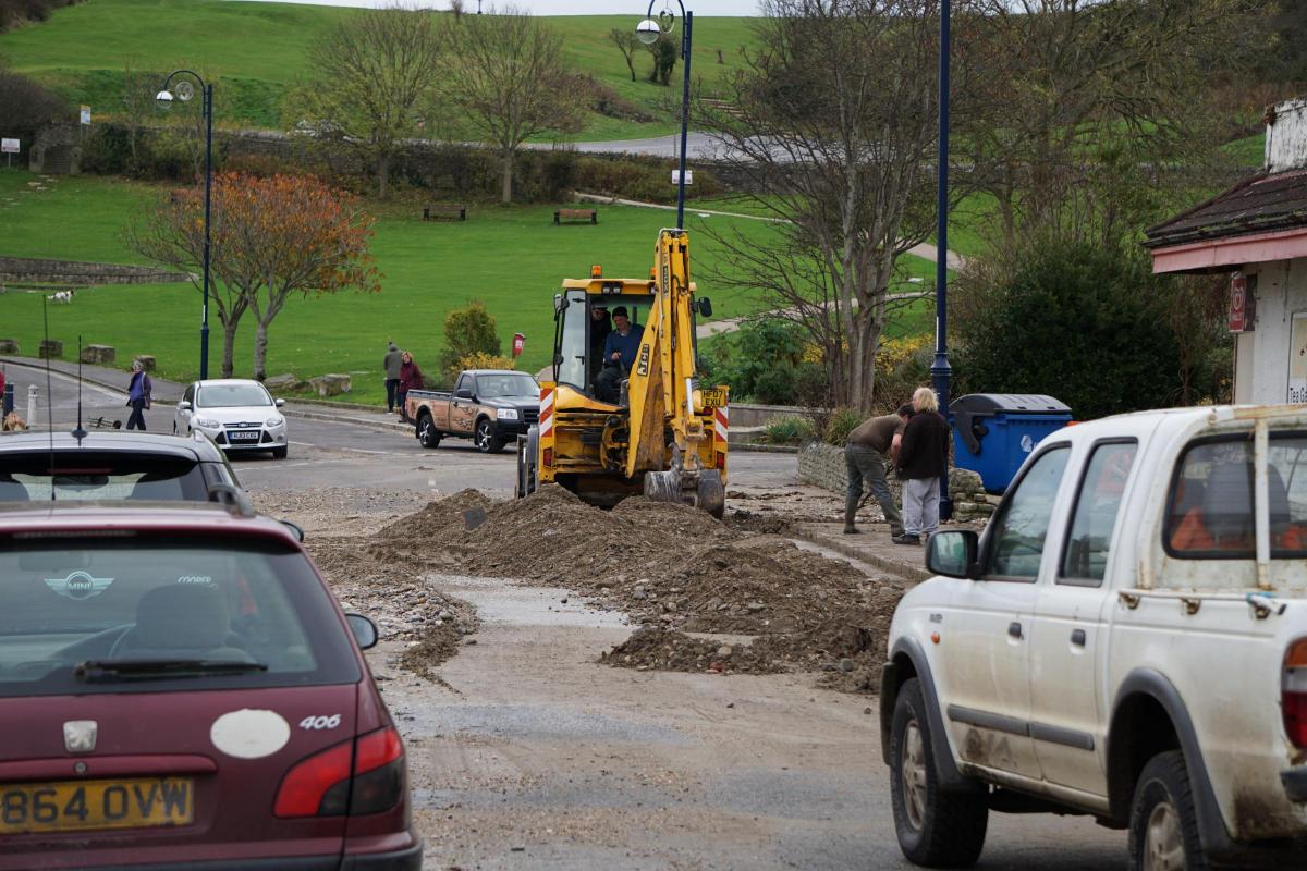
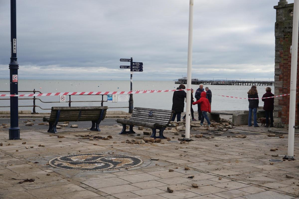
Dorset Police and Dorset and Wiltshire Fire and Rescue Service have urged people to stay clear of storm damaged areas, and the broken area of sea wall in Swanage has been cordoned off so repairs can be carried out.
Early on Sunday, Swanage Fire Station advised people to steer clear of the quayside.
"The strength of the sea is so strong that it broke part of the sea wall apart. The lower end of the High Street, The Square and The Parade are closed off and should be avoided," the crew said.
Fire crews were called to flooding elsewhere in Dorset including Poole Road in Wimborne and Cranleigh Road in Bournemouth, where there was deep water on the road underneath the railway bridge.
A crew of firefighters were called to a bungalow in Hillside Drive, Christchurch, at 10.35pm on Saturday after a tree fell onto the roof, knocking over the chimney stack.
Many homes in Blandford Forum and Sturminster Newton have been left without power for much of the day, with the last homes reconnected at 4pm.
The Met Office said heavy, persistent rain will spread across the South West tomorrow, with the heaviest rain expected in the early hours of the morning.
Although the more persistent rain should clear in the afternoon, heavy and possibly thundery showers are likely to follow, according to the warning.
The chief forecaster said: "Some 20-30mm of rain may fall in a 3-6 hour period in places, with as much as 40-60mm possible locally through the whole of Monday.
"The greatest risk of disruption due to flooding is expected to be across parts of South West England, Devon in particular, where the ground has been left very wet from Saturday night’s rain."
Drivers have been urged to be alert for surface flooding and wind-driven debris.
The Environment Agency has issued flood alerts for the River Avon and the River Stour due to the heavy rainfall.
The tributaries between Ringwood and Christchurch are rising and are forecast to exceed 'bankful conditions'.
Water levels in the upper River Stour and tributaries from Wincanton to Sturminster Newton are also expected to rise.


Comments: Our rules
We want our comments to be a lively and valuable part of our community - a place where readers can debate and engage with the most important local issues. The ability to comment on our stories is a privilege, not a right, however, and that privilege may be withdrawn if it is abused or misused.
Please report any comments that break our rules.
Read the rules hereLast Updated:
Report this comment Cancel