


A BLUEPRINT outlining sites for 14,200 new homes in Poole has been released by council chiefs.
Borough of Poole's (BOP) Poole Local Plan will essentially set out the authority's preferred sites for development up until 2033.
Last June, as part of the ongoing process to shape the draft plan, 50 possible housing sites, including some on green belt land, were put out for public consultation.
Today, following analysis of the results of that consultation, BOP has named the sites to go forward for inclusion in the final document.
These include:
800 homes on green belt land at Bearwood.
500 homes on green belt land at Merley.
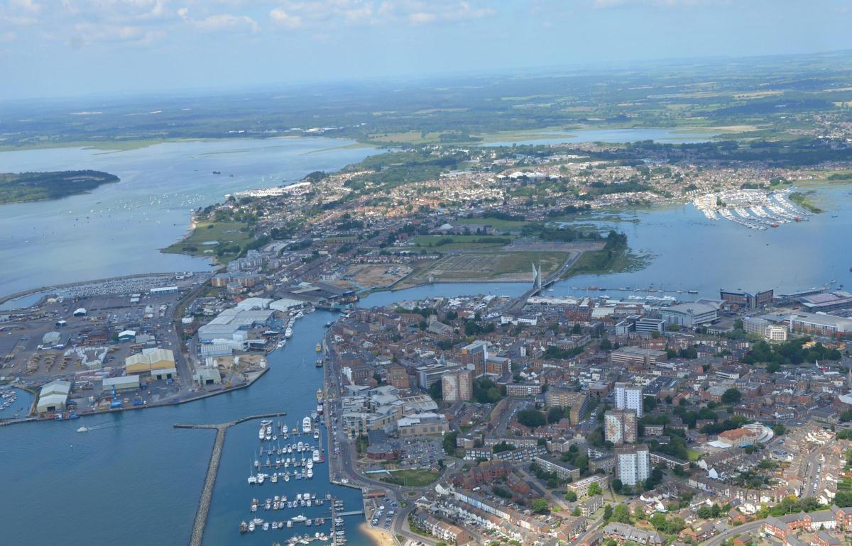
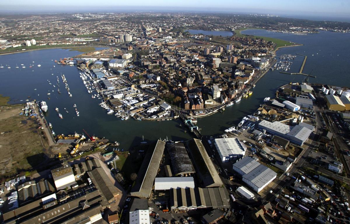
900 homes at former Poole Power Station site.
500 homes at Seldown car park and Dolphin Swimming Pool.
400 homes at Turlin Moor Recreation Ground
The document - which also contains preferred sites for employment land - will be debated by BOP's overview and scrutiny committee on June 21, before consideration from cabinet and full council.
Then, after a further round of public consultation this summer, it will be submitted to the Planning Inspectorate for approval, with a view to the council officially adopting the local plan next year.
BOP cabinet portfolio holder for planning and regeneration Cllr Ian Potter said: "The Poole Local Plan sets out the framework enabling us to meet the needs of our residents both now and in the future.
"It strikes the right balance between meeting needs and accommodating sustainable growth.
"It protects Poole’s economy, precious environment and housing for local people by having a robust and positive plan for Poole’s future."
Of the 14,200 new homes needed - a figure set out by government - around 12,900 could be developed on urban sites, a BOP spokesman said.
The borough says the shortfall of 1,300 homes can only be met through release of green belt land.
A BOP spokesman said: "BOP is committed to meeting Poole’s housing and other needs and the draft Poole Plan outlines sites for 6,000 homes in the town centre, 5,000 homes in other parts of the town that are most accessible via public transport, 1,900 in the rest of Poole’s urban area, 500 homes on green belt land in Merley and 800 on Green Belt land in Bearwood.
"To ensure the borough has sufficient provision for school places by 2033 land is also released from the green belt at Creekmoor to be reserved for education use."
BOP planning policy and implementation manager Nick Perrins said: "All local authorities have local plans,they set out the long-term framework for their area. Communities need confidence about where things will go.
"If you don't have one, or if your plan is out of date, then you can start to lose control.
"There are authorities close to here where they have lost control, because they don't have enough housing sites - they cannot meet their needs. Then the councils just get overrun with planning applications and you start to see bad decisions. You can lose control about inclusion of employment land, design decisions.
"It is really important for any council to shape their own area."
********************************************************
Poole Local Plan

Housing
T1 – Seldown Car Park and Dolphin Swimming Pool – 500 homes and supporting leisure / commercial development
T2 – Poole Stadium – 430 homes, stadium retained and supporting commercial development
T3 – Goods Yard – 300 homes and supporting commercial development
T4 – St Johns House – 200 homes
T5 – Former Natwest building – 150 homes
T6 – 6-12 Wimborne Road – 50 homes
T7 - Former Poole Power Station – 900 homes and supporting commercial development
T8 – Between RNLI and Twin Sails – 550 homes and supporting commercial development
T9 – Between the Bridges – 450 homes and supporting commercial development
T10 – Sydenham Timber Yard – 350 homes and supporting commercial development
T11 – Pilkington Tiles – 270 homes and supporting commercial development
T12 – Quay Thistle – 180 homes
T13 – Skinner Street and surrounds – 100 homes
T14 – Lagland Street and Hill Street – 60 homes
T15 – Poole Pottery – 50 homes plus retention of tourist facility
Other Urban Allocations:
U1 – Turlin Moor (N) – 400 homes plus community benefits
U2 – West of Bearwood – 300 homes plus employment land
U3 – Civic Centre and surrounds – 250 homes subject to relocation of Council / public buildings
U4 – Crown Closures – 155 homes including a 60 bed care home
U5 – Former Parrs Sweet Factory – 70 bed care home and 30 specialist accommodation homes
U6 – Sopers Lane – Around 100 homes and / or a 60 bed care home
U7 – Mitchell Road – 80 bed care home
U8 – Beach Road Car Park – 60 homes
U9 – Oakdale public buildings – 60 homes subject to re-provision of adult education centre
U10 – Gasworks Bourne Valley – 60 bed care home plus employment land
U11 – Former College Site – 55 homes
U12 – Creekmoor Local Centre – 50 homes plus supporting retail facilities
U13 – St Mary’s Maternity Hospital – 50 homes subject to relocation of existing facility
U14 – Roberts Lane – 45 homes plus investment in access improving access to Upton Country Park and the local centre
U15 – 60 Old Wareham Road to 670 Ringwood Road – 40 homes
U16 – Hillbourne School - Upgrades to existing school provision and 40 homes
Land proposed to be released from Green Belt:
UE1 – 500 homes, SANGs and supporting community facilities
UE2 – 800 homes, SANGs and supporting community facilities
Employment
E1: ‘Digital Village’, Talbot Village
E2: Magna Business Park, Bearwood
E3: Land at Sterte Avenue West
E4: Poole Port
E5: Gasworks, Bourne Valley
E6: Land at Innovation Close
E7: Land at Bournemouth Water
E8: Land south-east of Yarrow Road
E9: Land at Banbury Road
E10: Vantage Way, Mannings Heath
E11: Land at Marshes End, Creekmoor
E12: Land at Lifeboat Quay
E13: 3 Aston Way, Mannings Heath
E14: Area 2, Ling Road
Investing in Education
A1 – Land south of Creekmoor – land proposed to be released from the Green Belt to be reserved for education uses
A2 – Talbot Village – university related development


Comments: Our rules
We want our comments to be a lively and valuable part of our community - a place where readers can debate and engage with the most important local issues. The ability to comment on our stories is a privilege, not a right, however, and that privilege may be withdrawn if it is abused or misused.
Please report any comments that break our rules.
Read the rules hereLast Updated:
Report this comment Cancel