

It was hard to believe on Tuesday that it's nearly May.
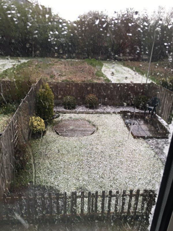
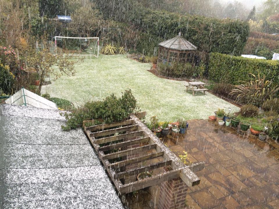
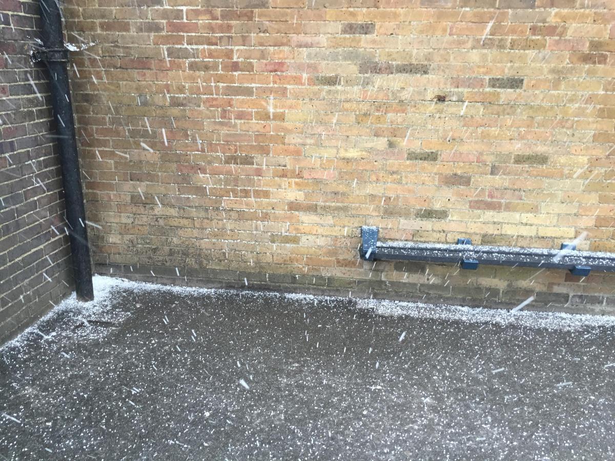
Many parts of Dorset received a dusting of white hail as scattered showers and thunder and lightning hit the county.
Residents from across Sandbanks, Christchurch, Blandford, Parkstone, Wimborne, Verwood and Swanage reported what many described as snow before the blazing sun returned to melt the slight downpour of ice away.
Despite residents experiencing brighter blue skies in April, the British weather continued to prove changeable during the bouts of hail, which some reported lasting just 30 seconds.
Hail at Bournemouth Hospital just now! @Bournemouthecho pic.twitter.com/f4CHdDycDu
— Sam Sheldon (@SamDailyEcho) April 26, 2016
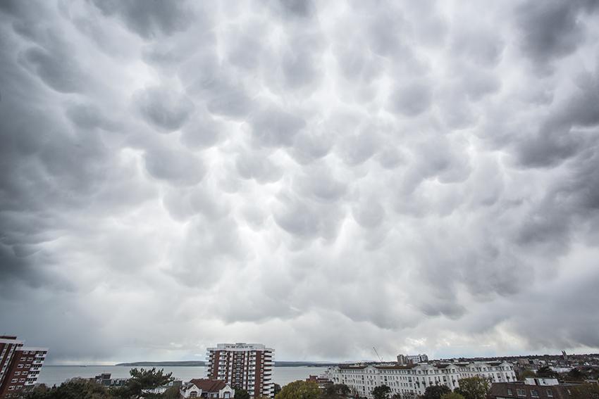
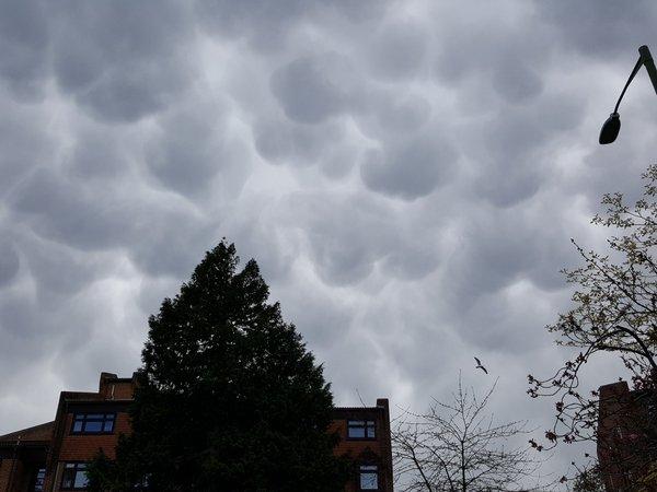
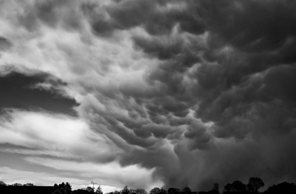
Then later in the day, unusual cloud formations - known as mammatus clouds - were seen across Dorset.
They are usually formed in association with large cumulonimbus clouds, particular when these are forming large thunderstorms and are distinctive because of the large bulges that form at the base of the cloud.
Dr Richard Wild, senior meteorologist at WeatherNet, based in Bournemouth, said: "It was nothing out of the ordinary as it was predicted that we may have rain, hail, snow and sleet.
"Based on the temperatures at the time, it was hail, which I saw bouncing off cars for myself, but it did appear to the layman as snow."
@Bournemouthecho We have seen snow in Blandford.
— Same Day Couriers (@SpeedyLogistics) April 26, 2016
@Bournemouthecho Strouden Park pic.twitter.com/D6nMhJTiZy
— James Elliott (@JimboLFC1981) April 26, 2016
Hearing reports of snow in Bournemouth. I would be truly shocked if it was snow as the temp is around 10c. V likely to be soft hail
— Jim Smith (@Jim_AFCB) April 26, 2016
Dr Wild said that there was a similar risk of showers today with potential for some sleet and hail, with another ground frost, before a slightly drier start on Thursday. Friday is expected to feature some sunshine and showers with predicted top temperatures of up to 11C.
Into the weekend, he said that there could be some showers and possibly more hail on Friday afternoon before a dry evening, with some showers on Saturday and Sunday.
Bank Holiday Monday will offer some 'summer temperatures' up to 14C with some cloud and a small amount of rain.
If you have a weather picture to send us, email digital@bournemouthecho.co.uk


Comments: Our rules
We want our comments to be a lively and valuable part of our community - a place where readers can debate and engage with the most important local issues. The ability to comment on our stories is a privilege, not a right, however, and that privilege may be withdrawn if it is abused or misused.
Please report any comments that break our rules.
Read the rules hereLast Updated:
Report this comment Cancel