
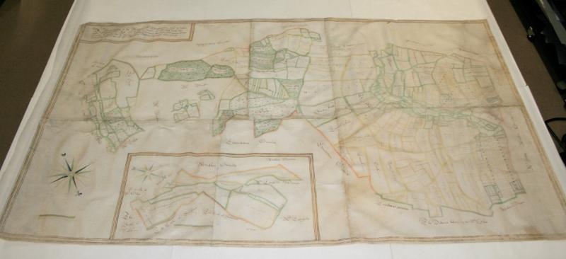
A 350-YEAR-old map showing the geography of an East Dorset estate has been restored to its former glory.
The rare document, which dates from 1659 and details the Wimborne St Giles estate, was handed to conservators at the Dorset History Centre.
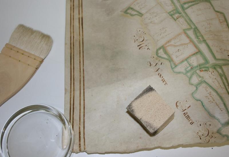
The painstaking restoration work, funded by owner Lord Shaftesbury, included cleaning, repairing and rejoining the six separate sheets of animal skin parchment.
In total, the project took several weeks.
The hand-drawn, colour map shows field systems and land ownership in mid-17th century Wimborne St Giles, and gives details of the topographical and agricultural features of the day.
The estate has been the home of the Ashley-Cooper family, Earls of Shaftesbury, since the 14th century.
It currently covers approximately 5,700 acres and sits alongside the Cranborne Chase Area of Outstanding Natural Beauty.
The family home is St Giles House.
Jenny Barnard of the Dorset History Centre said relatively few maps from this period have survived, and the document forms part of a very small number which can illuminate the past and inform us of continuity and change in our landscapes.
“Parchment is particularly challenging to work with as, exposed to high humidity, it tries to return to its original animal shape," she said.
"Re-joining the six skins so that the drawing aligned correctly was gratifyingly demanding and it is wonderful to see this beautiful map back in one piece.”
Lord Shaftesbury said: “We are extremely grateful for the skill and care the Dorset History Centre have displayed in conserving this old and important map.
"It’s immensely satisfying to see these objects brought back to life and preserved so that future generations can enjoy them.”
Dorset History Centre accepts private commissions of archival conservation.


Comments: Our rules
We want our comments to be a lively and valuable part of our community - a place where readers can debate and engage with the most important local issues. The ability to comment on our stories is a privilege, not a right, however, and that privilege may be withdrawn if it is abused or misused.
Please report any comments that break our rules.
Read the rules here