
HIGHWAY authorities dealing with the flooding risks posed by blocked drains are increasingly taking advantage of award-winning software devised by a Dorset company.
KaarbonTech developed a way for workmen to easily map the gullies they service and the state they leave them in.
The software has just won the 2014 Association of Geographic Information (AGI) award for Best Use of Geospatial for Business Benefit.
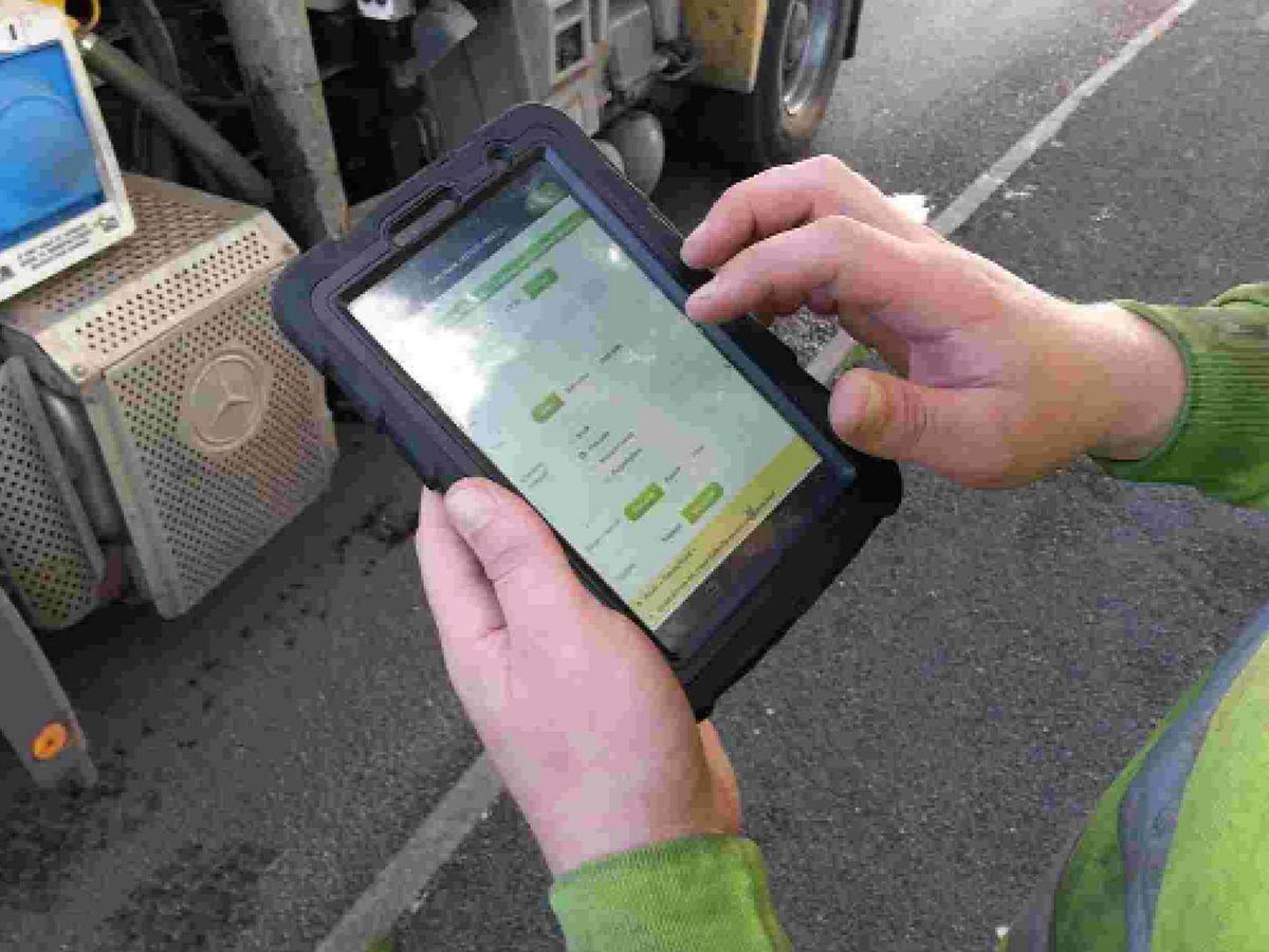
It enables council workers to easily use an Apple or Android device to take a snapshot of a feature such as a gully, with the information recorded on a map straight away with the aid of Geographical Information System (GIS) data from the Ordnance Survey. A worker can easily mark the location of gullies, the silt levels and the date and time they were emptied. The resulting map enables the highway authority to plan its maintenance, with the system producing markers for those gullies with high levels of silt.
KaarbonTech’s Christchurch-based managing director, Mark Entwistle, has a background in working with local authorities in utilities mapping.
“Let’s say there are 100,000 drains and the council cleans them once a year. There’s a lot of waste because they’re turning up to clean drains that don’t need cleaning,” he said.
The technology can be adapted for lampposts, potholes or anything else that needs inspecting on the ground, and can be used to raise invoices.
“My background is in working with these people and I realised it needed to be very quick and easy to use. It’s a dream to use,” said Mr Entwistle.
“We started with gullies and drainage because they represent the most risk and the most opportunity for savings.”
He said the arrival of fast tablets had made the technology possible.
“Ninety-nine point nine per cent of asset management systems out there use Windows. Android and IOS haven’t previously had the processing power and ability to do it,” he said.
He said the concept had impressed the Ordnance Survey when KaarbonTech demonstrated it. “We became partners with them and it developed from there,” he said.
The two-year-old company has a team of eight people from around the country who hold meetings online.
It also specialises in providing aerial surveying using unmanned aerial vehicles, or drones. It was commissioned to survey Queen Elizabeth Olympic Park last spring and has worked for the Womad Festival, the National Trust on Brownsea Island and South West Water.
Dorset County Council is looking at trialling the mapping system among others it is reviewing.


Comments: Our rules
We want our comments to be a lively and valuable part of our community - a place where readers can debate and engage with the most important local issues. The ability to comment on our stories is a privilege, not a right, however, and that privilege may be withdrawn if it is abused or misused.
Please report any comments that break our rules.
Read the rules hereLast Updated:
Report this comment Cancel